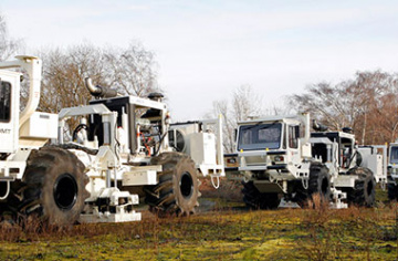
 Виконання польових сейсмічних досліджень
ТОВ Георозвідка виконує польові сейсмічні дослідження 2D з отриманням високоякісних первинних даних польової 2D сейсмічної зйомки.
Назва(англ):
Performing field seismic studies
Анонс(англ):
Georozvidka LLC performs 2D seismic surveys to obtain high quality primary 2D seismic survey data.
Детальний опис(англ):
The quality of the research allows to provide a modern technological level of processing and interpretation in solving a wide range of topical geological problems from regional, prospecting and detailing, in order to study and refine the geological structure of the sedimentary complex of rocks in the search and detailing of oil and gas fields, optimization of prospecting and search operational drilling.
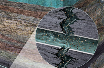 Геофізичний супровід при пошуках і розвідці родовищ
Компанія "Георозвідка" надає повний спектр послуг з геофізичного супроводу при пошуку та розвідці родовищ
Назва(англ):
Geophysical support in prospecting and exploration
Анонс(англ):
Georozvidka Company provides a full range of geophysical support services for prospecting and prospecting
Детальний опис(англ):
Geophysical conduit services include non-routine work:
• Providing fossil-free drilling of hydrogeological wells, determination of lithological composition and stratigraphic structure of the section;
• detection in the context of the presence of aquifers and corresponding water resistors, establishment of the internal structure of aquifers;
• determination of filter planting intervals, control of their correctness in relation to aquifers, determination of the flow rate of individual filter column intervals;
• establishment of depths, intervals and flow rates of aquifers in fractured reservoirs;
• establishing the true design of casing, detecting its tightness, determining the presence of fistulas in the casing, through which the contaminated water enters the well, creating a video image of the internal structure of the hydrogeological well;
• control of availability of possible connection of aquifers with surface, technogenically polluted, waters;
• radiological control of radioactive contamination of water
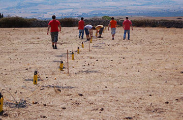 Пошуки та розвідка родовищ нафти і газу
ТОВ "Георозвідка" виконує геофізичні роботи при пошуку та розвідці родовищ нафти і газу.
Назва(англ):
Searches and exploration of oil and natural gas deposits
Анонс(англ):
Georozvidka LLC performs geophysical work in the field of oil and gas prospecting and exploration.
Детальний опис(англ):
The search for oil and gas fields is becoming more and more difficult every year, geophysics must be constantly improved - more and more technical solutions are needed here. Gerozvidka LLC is actively working in this direction, using advanced technologies and means of data processing and interpretation in its activity. The high quality of the geophysical work performed allows us to obtain results when searching for and exploring new ones and intensifying the development of existing oil and gas fields.
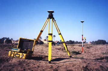 Топографо-геодезичні роботи
Компанія "Георозвідка" пропонуєм комплекс топографо-геодезичних робіт для реалізації будівельних проектів
Назва(англ):
Geophysical exploration of wells
Анонс(англ):
Georozvidka Company offer a complex of topographic-geodetic works for the realization of construction projects
Детальний опис(англ):
Topographic and geodetic works include surveying and topographic surveys, which are performed in the design, construction, and operation of various engineering structures, buildings, and other objects.
1. Topographic Surveying of Large Scale Plans 1: 100, 1: 200, 1: 500, 1: 1000, 1: 2000, 1: 5000;
2. Geodetic survey of terrain of any complexity;
3. Topographic-geodetic works on a survey of underground and above-ground structures, engineering communications;
4. Sub-tree topographic photography with the taxation of tree stands (each tree with parameters: species, height, trunk circumference is indicated).
5. Topographic-geodetic works in construction (Geodetic support of monolithic frame construction, construction of engineering structures and linear objects; Executive surveys during construction, operation, and reconstruction of various objects; Removal of the axes of buildings, structures and lines of engineering into nature br>
6. Surveying and surveying work;
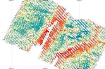 Обробка геофізичної інформації
ТзОВ "Георозвідка" надає послуги з обробки геофізичних даних.
Назва(англ):
Geological exploration logging
Анонс(англ):
Georozvidka LLC provides geophysical data processing services.
Детальний опис(англ):
The processing and interpretation of geophysical information is a key step in the exploration and development of fields. Thanks to the latest technologies used in carrying out these works, it is possible to study and interpret the results of seismic exploration in detail and finally to build maps of the location of oil layers, which will allow to determine with accuracy the location for future drilling.
Carrying out processing and interpretation in one company, allows to receive the most reliable and accurate information about hydrocarbon deposits. This is due to the complexity and complexity of the seismic data processing and interpretation process. Working together, professionals can reduce errors and compare the results of their research. As a result, the customer receives an accurate forecast based on the data obtained by the researchers.
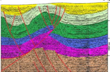 Інтерпретація геофізичної інформації
ТОВ Георозвідка надає послуги з інтерпретація геолого-геофізичних даних.
Назва(англ):
Electrical, magnetic and gravity exploration
Анонс(англ):
Georozvidka LLC provides services in the interpretation of geological and geophysical data.
Детальний опис(англ):
The interpretation of geological-geophysical materials is performed according to the technological scheme, which provides a multilateral study of seismic data in combination with other geological-geophysical materials for solving the geological problems.
Modern software, constantly improving computer facilities with high speed and high professionalism of specialists has allowed shortening the time of work performed and significantly improve the quality of data processing results. Thanks to the high qualification of employees and the use of the latest technologies, the most advanced methods of interpretation of geophysical information are used.